


Wellbots
Garmin ECHOMAP Chartplotters - Transducer - Fishing Smart Navigator
Garmin ECHOMAP Chartplotters - Transducer - Fishing Smart Navigator
Couldn't load pickup availability
Garmin ECHOMAP Chartplotters - Transducer - Fishing Smart Navigator
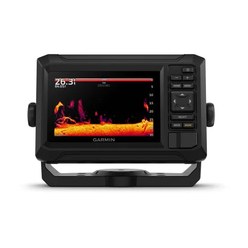
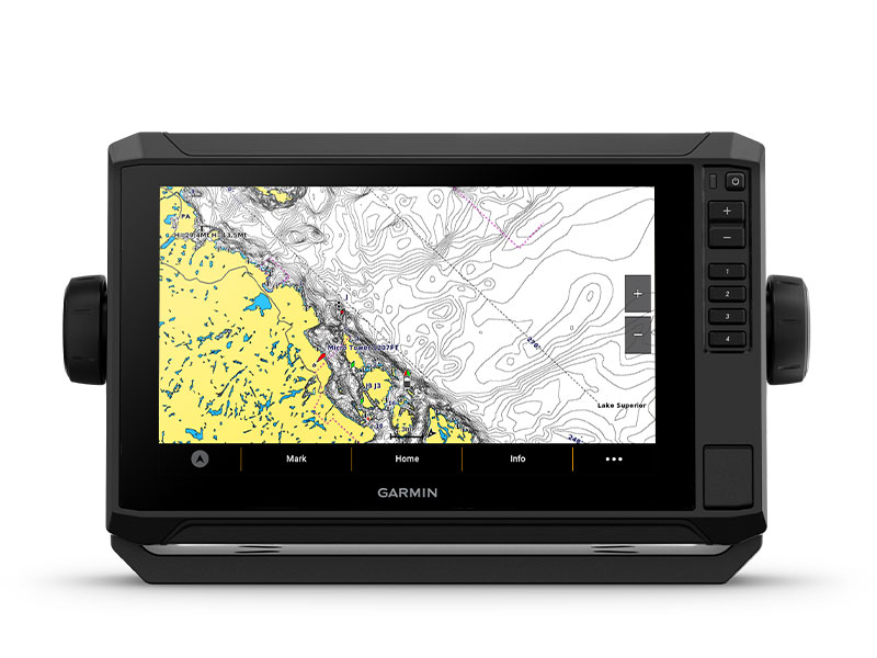
When it comes to catching more fish, they say, “Talk to a local.” With the ECHOMAP UHD2 chartplotter, which offers our best-in-class sonar and mapping and premium touchscreen display with keyed-assist, you’ll know the water even better than they do.
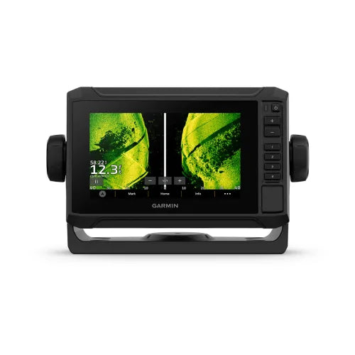
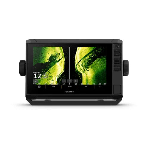
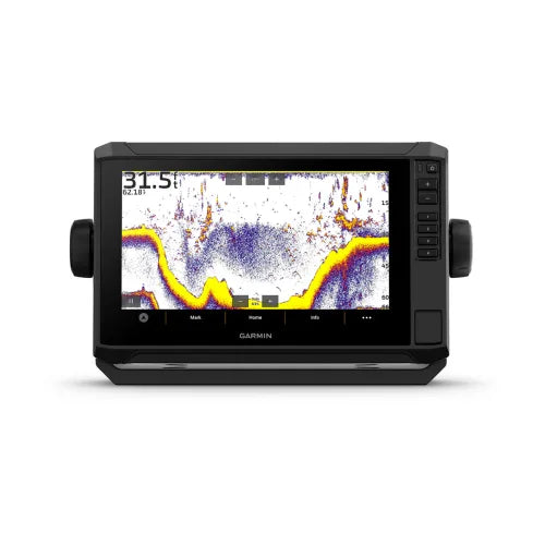
- The bright 6”, 7” or 9” touchscreen display with keyed-assist is user-friendly and easy to read.
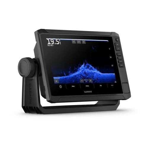
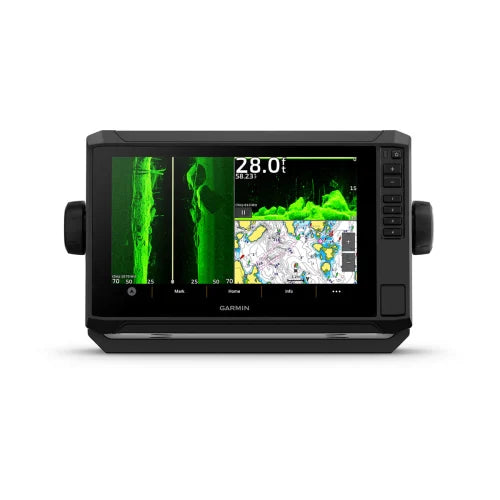
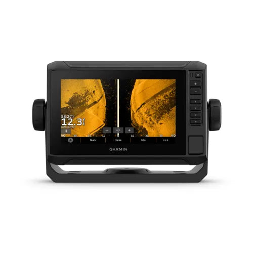
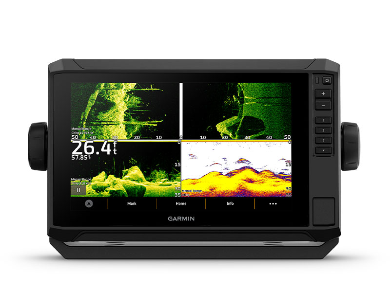
- Good things come in threes. Three sonar types, that is: Garmin traditional, ClearVü™ and SideVü™ sonars.
- Improved detail? Check. Distinguished targets? Yep. That’s the beauty of high-contrast vivid color palettes.
- If you’re running another ECHOMAP UHD2 chartplotter, you can wirelessly share sonar, waypoints and routes.
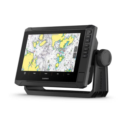
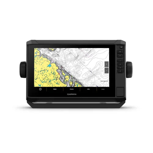
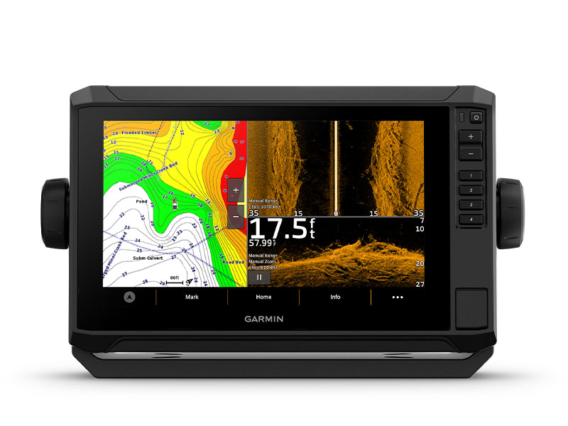
- Want our best in mapping? Who doesn’t? Select chartplotters come with Garmin Navionics+™ mapping.
What's in the box
With Transducer
- ECHOMAP UHD2 (device varies depending on selection)
- GT56-TM transducer
- Power cable
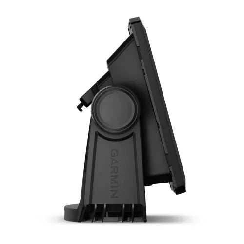
- Tilt mount with quick-release cradle
- Protective cover
- Hardware
- Documentation
Without Transducer
- ECHOMAP UHD2 (device will vary depending on selection)
- 12-pin sounder to 8-pin transducer cable
- Power cable
- Tilt mount with quick-release cradle
- Protective cover
- Hardware
- Documentation
SONAR SUPPORT
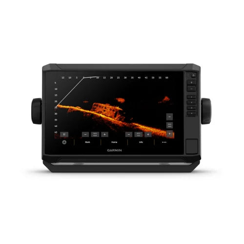
With crisp, clear traditional sonar and brilliant ClearVü and SideVü scanning sonars, the fish will have nowhere to hide. Your ECHOMAP UHD2 also supports LiveScope™ live-scanning sonar.

VIVID COLOR PALETTES
High-contrast vivid scanning sonar color palettes make it easier than ever to distinguish targets and structure.
BUNDLE YOUR TRANSDUCER
Your ECHOMAP UHD2 device supports a variety of Garmin transducers. The 6” and 7” chartplotters come bundled with a GT54 transducer — while the 9” chartplotter comes with a GT56 transducer.

PRELOADED CHARTS
You’ve never seen Garmin cartography like this before. Select chartplotters come with built-in Garmin Navionics+ cartography which includes a 1-year subscription for daily updates, depth range shading and more.
WIRELESS NETWORKING
If you have another compatible ECHOMAP UHD2 chartplotter on your boat, you can wirelessly share information — such as sonar1, waypoints and routes — with them.
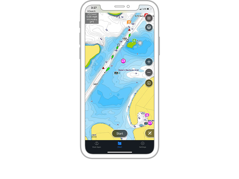
ACTIVECAPTAIN® APP
Built-in Wi-Fi® connectivity pairs with the free all-in-one mobile app on your compatible smartphone for access to the OneChart™ feature, smart notifications, software updates, Garmin Quickdraw™ Community data and more2.
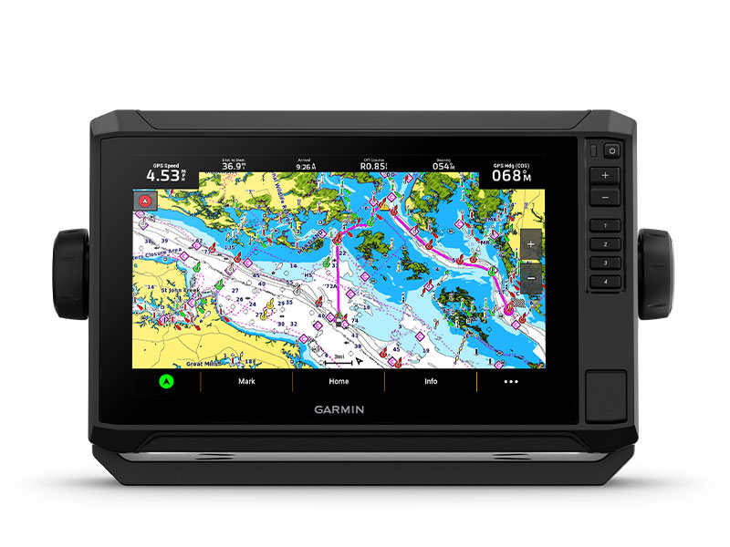
AUTO GUIDANCE+™ TECHNOLOGY
Chartplotters with built-in Garmin Navionics+ charts include downloadable Auto Guidance+ technology3 with the ActiveCaptain app.

TROLL WITH FORCE®
Your ECHOMAP UHD2 wirelessly connects to your Force trolling motor to create and follow routes, navigate to waypoints, control speed, check battery life and more.
MULTI-BAND GPS
Get improved position accuracy, particularly in areas where signals are reflected or weak, with multi-band GPS.
General |
|
| DIMENSION | 10.4" x 6.5" x 3.2" (26.4 x 16.6 x 8.0 cm) |
|---|---|
| TOUCHSCREEN | |
| INPUT | Touchscreen with Keyed Assist |
| DISPLAY SIZE | 7.8" x 4.5", 9.0" (19.8 x 11.5 cm, 22.9 cm) |
| DISPLAY RESOLUTION | 1024 x 600 pixels |
| DISPLAY TYPE | WSVGA, TN |
| WEIGHT |
2.9 lbs (1.3 kg) |
| WATERPROOF |
IPX7 |
| MOUNTING OPTIONS | Bail or flush |
Maps & Memory |
|
| ACCEPTS DATA CARDS |
1 microSD™ card; 32 GB maximum size |
|---|---|
| WAYPOINTS |
5,000 |
| TRACK POINTS | 50,000 |
| TRACKS | 50 saved tracks |
| NAVIGATION ROUTES | 100 |
Sensors |
|
| HAS BUILT-IN RECEIVER | |
|---|---|
| RECEIVER |
10 Hz |
| NMEA 2000 COMPATIBLE | |
| GPS | |
| GLONASS | |
| GALILEO | |
| BEIDOU | |
| SUPPORTS WAAS | |
| SUPPORTS MULTI-BAND, MULTI-CONSTELLATION GPS | |
Built-in Maps |
|
| BUILT-IN AUTO GUIDANCE+ | yes (downloadable via ActiveCaptain app) |
|---|---|
| GARMIN NAVIONICS+ INLAND & COASTAL | yes (see Additional) |
| GARMIN NAVIONICS+ (COASTAL) | yes (see Additional) |
| GARMIN NAVIONICS+ (INLAND) | yes (see Additional) |
| TIDE TABLES | yes (see Additional) |
Optional Map Support |
|
| GARMIN NAVIONICS+™ | |
|---|---|
| GARMIN NAVIONICS VISION+™ | |
| TOPO | |
| STANDARD MAPPING | |
| GARMIN QUICKDRAW CONTOURS | |
Chartplotter Features |
|
| AIS | |
|---|---|
| DSC | |
| SUPPORTS FUSION-LINK™ COMPATIBLE RADIOS | |
| ACTIVECAPTAIN® COMPATIBLE | |
| SAILING FEATURES | |
Sonar Features & Specifications |
|
| DISPLAYS SONAR | |
|---|---|
| POWER OUTPUT | 500 W |
| TRADITIONAL SONAR (DUAL FREQUENCY/BEAM) | built-in (single channel CHIRP, 50/77/83/200 kHz, L, M, H CHIRP) |
| CLEARVÜ | built-in 260/455/800/1000/1200 kHz |
| SIDEVÜ | built-in 260/455/800/1000/1200 kHz |
| PANOPTIX™ SONAR | |
| LIVESCOPE | |
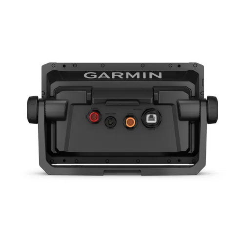
Connections |
|
| NMEA 2000® PORTS | |
|---|---|
| GARMIN MARINE NETWORK PORTS |
1 |
| 12-PIN TRANSDUCER PORTS | 1 |
| BLUETOOTH® PAIRING | |
| ANT+ (CONNECTIVITY) | |
| GARMIN WI-FI NETWORK (LOCAL CONNECTION) | |
Electrical Features |
|
| POWER INPUT | 9 to 18 Vdc |
|---|---|
| TYPICAL CURRENT DRAW AT 12 VDC | 1.72 A |
| MAXIMUM CURRENT DRAW AT 12 VDC | 3.5 A |
| MAXIMUM POWER USAGE AT 10 VDC | 20.7W |
Additional |
|
| ADDITIONAL |
|
|---|---|